Pull almost any piece of bulk mail out of your box and you’ll spot a short string of letters and numbers printed near the address. Most people never give it a second glance. But that little code decides which carrier handles your address, and it’s a big part of how the USPS reaches more than 160 million addresses a day without the whole thing falling apart.
That code points to a carrier route, and the system behind it is called carrier route mapping. This guide breaks down what a carrier route is, the different route types, how to run a carrier route lookup, and how any delivery business can copy the same approach to cut planning time and fuel costs. Bodha does precisely that, and we’ll get to how near the end.
What a USPS carrier route actually is
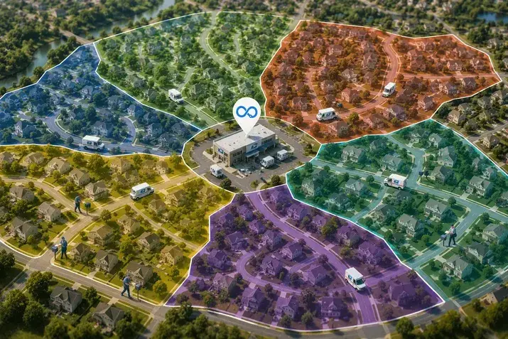
In short: a carrier route is the group of addresses one mail carrier covers in a single day. Rather than treating a whole ZIP code as one giant block, the Postal Service splits it into smaller pieces, each small enough for one person to finish on a normal shift.
Every route gets a nine-character code. It looks technical, but it reads easily once you know the parts. Here’s 60614C008 broken apart:
- 60614 is the ZIP code
- C is the route type (a City route, in this case)
- 008 is the route number inside that ZIP
So 60614C008 simply means City Route 8 in ZIP code 60614. That code is what lets mail get sorted, tracked, and targeted right down to a single neighborhood.
A bit of context on scale:
- The average ZIP code holds around 8 carrier routes
- Dense cities can climb to 14 or 15 routes per ZIP
- Rural areas may drop to just 3 or 4
- A single route usually covers 300 to 600 deliveries a day
The 5 types of USPS carrier routes
Carrier routes come in five official types. Most guides only cover the first three, so here’s the full list straight from the USPS Domestic Mail Manual, including the two that rarely get a mention:
- City routes (C): dense urban and suburban areas where addresses sit close together. Carriers often drive part of the way and walk the rest to clear apartment blocks and tight streets.
- Rural routes (R): wide areas where homes are spread far apart, so carriers stay in their vehicles and rely on roadside mailboxes.
- Highway Contract Routes (H): routes run by contractors instead of postal employees, usually in remote spots or for delivery needs that don’t fit the city or rural mold.
- Post Office Box Sections (B): clusters of P.O. boxes treated as their own delivery unit.
- General Delivery Units (G): a holding service for people without a fixed address, where mail waits at the post office for pickup.
City, Rural, and Highway Contract routes do most of the daily heavy lifting, but the B and G prefixes still turn up in route data and are worth recognizing.
How the Postal Service plans and updates its routes
There’s real logic behind where each of these USPS delivery routes begins and ends. Three things drive it:
- Natural boundaries. Routes follow physical lines like main roads, rivers, rail tracks, and city limits, which keeps carriers from crossing awkward barriers mid-shift.
- Address density. Tightly packed areas get routes with a small footprint but lots of stops. Spread-out areas cover more ground with fewer stops along the way.
- Workload. Each route is sized to fill roughly a full day for one carrier, keeping staffing fair and the schedule steady.
Once the boundaries are set, the addresses inside get arranged in a sensible order so nobody doubles back. That ordering is the exact idea good routing software automates today: cut the distance, kill the backtracking.
Routes don’t stay frozen, either. New homes get checked against nearby routes and current workloads before they’re assigned, carriers use handheld devices for sequencing and delivery scans, and the Postal Service watches historical volume to brace for busy seasons. The network basically retunes itself over time, which is a lesson any growing delivery operation can borrow.
How to look up a carrier route or find a USPS route map
Sooner or later, if you’re running mailings or planning deliveries, you’ll want to do a carrier route lookup. There’s no free public tool that spits out an exact route code from a street address, but you’ve got a few solid options:
- Start with the ZIP+4. The USPS lookup tool gives you the full ZIP+4 for any address, and the carrier route is tied closely to that extended code.
- Run a CASS-certified process. This cleans up your addresses and attaches the carrier route code to every record automatically. Most direct-mail and list-cleaning services offer it.
- License boundary data. Since the USPS doesn’t publish a free, address-level route map, commercial vendors build and maintain those boundaries (usually refreshed quarterly) and sell them in formats like SHP, KML, or GeoJSON.
- Ask your local post office. For a single address, they can often tell you the route on the spot.
Quick tip: Always run your mailing list through CASS certification before a campaign. It scrubs bad addresses, appends the carrier route code, and can qualify you for a lower postage rate, all in one pass.
One thing worth clearing up, since it’s the question that comes up most. The Postal Service does keep detailed internal maps showing route boundaries and delivery order, but it doesn’t release a full, address-level carrier route map to the public, mostly for security and privacy reasons. What you can get openly are ZIP code maps and the licensed boundary products from data vendors.
So why bother with any of this? A USPS route map and route codes let you:
- Target direct mail to every address on a chosen route at a lower postage rate
- Plan deliveries around how an area naturally breaks apart
- Keep your address data clean so fewer pieces come back undelivered
Bringing postal-level routing to your own deliveries
Strip away the postal jargon and carrier route mapping is really just one thing: grouping stops into efficient, balanced, repeatable territories. That’s exactly what couriers, food and grocery delivery, pharmacies, retailers, and field-service teams all need to get right.
The trouble is doing it by hand. Here’s the difference once software takes over the sequencing:
Planning routes manually usually means:
- backtracking across town because the stops were never put in order
- guessing at delivery windows and missing a few
- burning fuel on a route that only looked fine on a map
- losing an hour every morning before anyone leaves the depot
Letting software handle it looks more like:
- a clean, neighborhood-by-neighborhood flow with no doubling back
- routes that respect time windows and priorities automatically
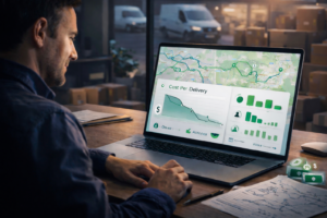
- 20% to 30% less fuel for the same deliveries
- finishing earlier with more stops covered
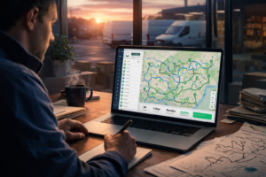
Good software works out the best order for hundreds of stops in seconds while respecting delivery windows, vehicle capacity, and driver schedules. It adjusts to live traffic, lets dispatchers move stops between drivers when the day shifts, and keeps customers in the loop with automatic texts and emails. Connect it to the ecommerce, order management, CRM, and ERP tools you already use, and routing just becomes part of how you work.
Where Bodha fits in
Bodha takes the routing discipline that makes the Postal Service so efficient and hands it to delivery teams of any size, with flexibility a fixed mail route never needs. It was built by people who came out of logistics operations and got tired of the same routing headaches, so it’s aimed at turning a morning of manual planning into a couple of clicks.
You can run it three ways:
- Bodha Drive for solo drivers: add stops fast and optimize unlimited stops a day, with turn-by-turn navigation on iOS and Android, plus proof of delivery and reporting built in.
- Bodha Fleet for multi-driver teams: the complete platform, with every feature Bodha offers, including route optimization across unlimited drivers and vehicles, live tracking from a dispatcher dashboard, customer notifications, proof of delivery, package scanning, and route analytics.
- White Label for businesses that want their own brand on the platform, using Bodha’s API and custom domains.
Out of the box you also get AI route optimization that factors in traffic, time windows, and vehicle capacity, drag-and-drop adjustments, real-time GPS tracking with predicted ETAs, automatic SMS and email updates on branded tracking pages, proof-of-delivery capture, a built-in package scanner, route analytics, and bulk address import via Excel, CSV, or API.
What teams actually see after switching:
- Fuel costs down by as much as 30%
- 20 or more extra stops per day
- About an hour saved daily
- Over $400 in monthly savings, with most teams set up inside an hour
Bodha is also SOC 2 certified, GDPR compliant, secured with 256-bit encryption and a 99.9% uptime guarantee, and works across more than 190 countries.
If courier or postal delivery is your world specifically, there’s a version built for that exact workflow. Take a look at the Courier and Postal Services route planner, or just try Bodha free for seven days. No credit card needed.
Frequently asked questions
1. How do I find my USPS carrier route?
The easiest way is the free USPS ZIP code lookup tool: enter your address and it returns the ZIP+4, which is tied to your carrier route. For the exact route code, run the address through CASS-certified software or ask your local post office, since they can usually tell you on the spot.
2. What does a USPS carrier route code mean?
A carrier route code is nine characters that read in three parts. The first five digits are the ZIP code, the next letter is the route type (C for City, R for Rural, H for Highway Contract, B for P.O. Box section, G for General Delivery), and the last three digits are the route number. So 60614C008 is City Route 8 in ZIP 60614.
3. Is there a USPS carrier route map I can look at?
Not a free, address-level one. The USPS keeps detailed internal maps but doesn’t publish them publicly, mainly for security and privacy reasons. You can view ZIP code maps for free, and commercial data vendors sell full carrier route maps with boundaries drawn along streets.
4. How many carrier routes are in a ZIP code?
About eight on average. Busy urban ZIP codes can have 14 or 15, while rural ZIPs might have only a few. The full range runs from a single route to more than 60.
5. What’s the difference between a ZIP code and a carrier route?
A ZIP code is the broad postal area. A carrier route is a smaller slice inside that ZIP, made up of the specific addresses one mail carrier delivers to in a day. One ZIP code usually contains several carrier routes.
6. How can a delivery business use carrier routes to plan deliveries?
By copying the logic the USPS relies on: group stops by density, put them in a smart order, and keep driver loads balanced. Carrier route mapping software like Bodha does this automatically, sequencing hundreds of stops in seconds so drivers cover fewer miles and fit in more deliveries each day.